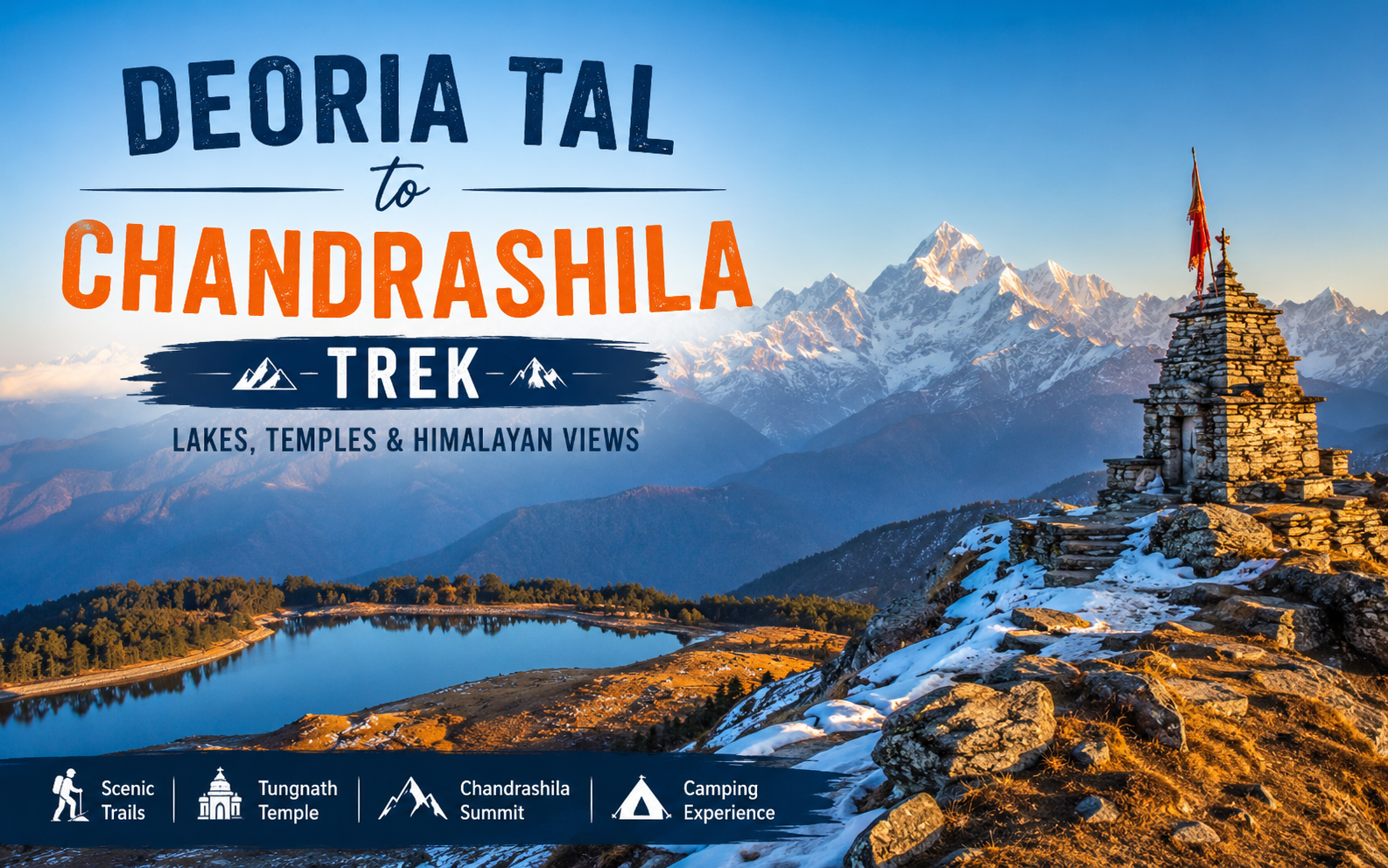
The Deoria Tal Chandrashila Trek is widely known as one of the most famous short treks in Garhwal Himalayas. It offers a unique combination of a high-altitude lake, a historic temple and a memorable summit experience.
The Deoria Tal Chandrashila Trek is located in the Rudraprayag district of Uttarakhand and does not require any technical climbing experience. There are no rope sections and no glacier crossings involved. What it does require is a reasonable level of fitness and a willingness to walk at altitude, and in return, it offers direct views of Chaukhamba, Nanda Devi, Trishul, and the wider Kedarnath range.
This guide covers the essential details required to plan the trek: distance, altitude, route, best season, permits, packing requirements, budget, and answers to the questions trekkers most commonly ask.
Quick Facts About the Deoria Tal Chandrashila Trek
| Detail | Information |
| Location | Rudraprayag District |
| State | Uttarakhand, India |
| Region | Garhwal Himalayas |
| Duration | 4 to 6 days (including travel) |
| Difficulty Level | Easy to Moderate |
| Maximum Altitude | Approx. 12,083 ft (3,690 m) at Chandrashila |
| Trek Distance | Approx. 28 to 30 km (round trip) |
| Best Time to Visit | March to June, September to December |
| Starting Point | Sari Village (via Rishikesh) |
| Ending Point | Chopta |
What is the Deoria Tal Chandrashila Trek?
The Deoria Tal Chandrashila Trek is a trek in the Indian state of Uttarakhand․ It connects the alpine lake of Deoria Tal to Chandrashila peak through Chopta‚ Tungnath Temple and Chandrashila․ The trek from Sari to Chandrashila is 28 to 30 km long with an altitude climbing from 6‚600 ft at Sari to 12‚083 ft at Chandrashila‚ considered to be one of the most beautiful short treks in the Garhwal Himalayas․
Some people consider the trek in two sections․ The first part goes up to Deoria Tal. It is an alpine lake that shows a picture of Mount Chaukhamba on a clear day.
The second part climbs through Chopta and Tungnath Temple to the Chandrashila summit.
There is a shrine, at the summit. It is dedicated to Chandra Devta, the moon god.
Why is the Deoria Tal Chandrashila Trek Famous?
The trek is famous for the amazing things you can see and do in a short time.
There are some reasons why people love this trek so much. Here are a few:
- The Chaukhamba reflection at Deoria Tal is really outstanding. When the morning is clear you can see the whole Chaukhamba mountain range reflected in the lake.
- The Tungnath Temple is a must watch. It is the temple in the world that is dedicated to Shiva and it has a lot of mythological significance because of the Pandavas from the Mahabharata.
- The sunrise at Chandrashila is beyond mesmerising. From the top you can see the sun rising over Chaukhamba and Nanda Devi. It is always the best part of the trek.
- The rhododendron forests are lovely. From March to May the path near Deoria Tal is filled with blooming rhododendron trees.
- Anyone can do this trek. The trek does not go up high too fast so it is good for people who are trekking for the first time but it is also good, for people who have trekked before because it has a lot of nice views and interesting culture especially the trek itself.
Deoria Tal Chandrashila Trek Distance and Altitude
The total trekking distance for the Deoria Tal Chandrashila Trek is approximately 28 to 30 km round trip. Deoria Tal sits at about 8,000 ft (2,438 m), Tungnath Temple at about 12,073 ft (3,680 m), and the Chandrashila summit at about 12,083 ft (3,690 m), the highest point on the trek.
| Point | Altitude |
| Deoria Tal | ~8,000 ft (2,438 m) |
| Tungnath Temple | ~12,073 ft (3,680 m) |
| Chandrashila Peak | ~12,083 ft (3,690 m) |
| Total Trek Distance | ~28 to 30 km |
These figures vary slightly across trekking operators depending on the specific trail variation used, and should be treated as close approximations rather than fixed values.
Deoria Tal Chandrashila Trek Route
The standard route for the Deoria Tal Chandrashila Trek is as follows:
Rishikesh → Sari Village → Deoria Tal → Chopta → Tungnath → Chandrashila → Chopta
The trek begins with a road journey from Rishikesh to Sari, the last motorable village and the designated base camp. From Sari, a climb of 3 to 4 km through oak and rhododendron forest leads to Deoria Tal. This point, the route proceeds toward Chopta, either directly or via Baniya Kund and the Rohini Bugyal meadows, depending on the operator. From Chopta, a marked trail ascends to Tungnath Temple and continues on a steeper section to the Chandrashila summit, after which trekkers descend back to Chopta.
Detailed Day-Wise Itinerary for the Deoria Tal Chandrashila Trek
#Day 1: Arrival at Sari Village and Trek to Deoria Tal
The group travels by road to Sari 190 km (120 mi) away from Rishikesh‚ a 7 to 8 hour drive via Devprayag where the Bhagirathi and Alaknanda rivers meet to form the Ganga․ They trek another distance of 3 to 4 km (1․9 to 2․5 mi) to reach Deoria Tal‚ where they camp for the night․
#Day 2: Deoria Tal to Chopta
This is usually the longest day of the trek․ One has to walk along a forest trail of the Rohini Bugyal meadows to reach the Chopta or an intermediate camp site at Baniya Kund‚ through dense cover of rhododendron forests and close views of mountains in Garhwal․
#Day 3: Tungnath Temple and Chandrashila Summit Trek
From Chopta‚ one walks through a birch forest and meadow to reach Tungnath temple․ From there‚ a steep trek of 1․5 to 2 km leads to Chandrashila summit․ Most groups reach the top by mid-morning‚ spend some time at the top enjoying the views and return to Chopta by afternoon․
#Day 4: Return Journey
The return trip is likewise through Chopta to Rishikesh or Dehradun via Ukhimath and Devprayag‚ and the itinerary may include an extra buffer day in case of weather-related delays along the route․
Best Time for the Deoria Tal Chandrashila Trek
| Season | Months | Advantages | Disadvantages |
| Spring | March to April | Rhododendrons in bloom, pleasant weather | Occasionalsnow at higher points |
| Summer | May to June | Clear skies, warm days, suitable for families | Crowded trails, particularly on weekends |
| Monsoon | July to August | Lush greenery, dramatic cloud cover | Slippery trails, leeches, risk of landslides |
| Autumn | September to November | Clear mountain views, crisp air | Cold nights, especially in November |
| Winter | December to February | Snow-covered trail, distinct scenery | Very cold conditions, some sections may be inaccessible |
The best time for the Deoria Tal Chandrashila Trek is generally considered to be March to June and September to December, when visibility and trail conditions are most favourable.
Weather Conditions on the Deoria Tal Chandrashila Trek Throughout the Year
Daytime temperatures during spring and autumn remain generally comfortable for trekking, though nights can approach freezing even in warmer months due to the altitude. Summer days are typically mild, though afternoon showers can occur by June. Monsoon months bring heavy rainfall and are generally not recommended for first-time trekkers. Winter brings snow, particularly near Tungnath and Chandrashila, with night temperatures falling well below freezing.
Difficulty Level of the Deoria Tal Chandrashila Trek
The Deoria Tal Chandrashila Trek is graded easy to moderate, making it suitable for beginners with a reasonable level of fitness. The gradual altitude gain allows for natural acclimatization, and the trail does not require technical climbing skills, although the final approach to Chandrashila involves a steeper and more demanding section.
Things to See on the Deoria Tal Chandrashila Trek
- Deoria Tal Lake:Known for reflecting the Chaukhamba massif under calm conditions.
- Himalayan sunrise:Best viewed from the Chandrashila summit.
- Rhododendron forests: Most prominent between March and May.
- Tungnath Temple:The highest Shiva temple in the world, with strong ties to Mahabharata mythology.
- Chandrashila summit:The highest point of the trek, marked by a small shrine to the moon god.
- Himalayan peaks visible from the summit: Including Nanda Devi, Trishul, Chaukhamba, and the Kedarnath range.
Flora and Fauna Along the Deoria Tal Chandrashila Trek
Oak, birch, and rhododendron trees line the trail. The forest grows thicker as the altitude rises. Part of this route falls inside the Kedarnath Wildlife Sanctuary buffer zone. This area is home to the Himalayan monal and musk deer. The Himalayan black bear also lives here, though sightings are rare. Birdwatchers often spot pheasants along the way. Mountain songbirds show up too, especially near Rohini Bugyal.
How to Reach the Deoria Tal Chandrashila Trek
- By AirThe nearest airport is Jolly Grant Airport in Dehradun, approximately one hour from Rishikesh, which serves as the primary gateway city for the trek.
- By TrainThe nearest railway station is Rishikesh Railway Station. Haridwar, located about 25 to 30 km away, serves as a well-connected alternative.
- By RoadFrom Rishikesh, the drive to Sari village, the trek’s base camp, covers approximately 190 km and takes about 7 to 8 hours via Devprayag and Ukhimath. Shared taxis and pre-arranged pickups are commonly available from Rishikesh.
Accommodation and Camping on the Deoria Tal Chandrashila Trek
Most itineraries include Deoria Tal camping, with tents set up beside the lake for one night. Sari village offers basic guesthouses and homestays for the night preceding the trek. Chopta also has a limited number of guesthouses and hotels, providing an alternative to tented accommodation ahead of the summit day.
Permits and Entry Fees for the Deoria Tal Chandrashila Trek
Part of this trail runs near the Kedarnath Wildlife Sanctuary buffer zone. A small forest entry fee applies here. Trek operators usually collect this at the entry checkpoint. Some packages already include this fee. Either way, carry valid ID with you. An Aadhaar card or passport works fine. You will need it for registration at the base camp.
Essential Tips for the Deoria Tal Chandrashila Trek
- Start each day’s trek early. This helps you avoid afternoon clouds and reach camp before dark.
- Carry enough water with you. Some stretches, especially near Chandrashila, have no water sources at all.
- Pack layered clothing instead of one heavy jacket. Temperatures shift fast as you climb higher.
- Break in your trekking shoes before the trip. This lowers your risk of blisters.
- Book a licensed guide or a reputed operator. This matters most for first-time Himalayan trekkers.
Nearby Places to Visit Around the Deoria Tal Chandrashila Trek
#Chopta: People call it the “Mini Switzerland of Uttarakhand.” It has lovely meadows and pine forests.
#Ukhimath: This town is the winter seat of the Kedarnath deity. It holds several old temples too.
#Kedarnath Wildlife Sanctuary: known for its Himalayan flora and fauna.
#Tungnath Temple: a significant pilgrimage site. Located directly along the trek route.
The Deoria Tal Chandrashila Trek demonstrates that a meaningful Himalayan experience does not require an extended itinerary or advanced mountaineering skills. Within a structured four-to-six-day journey, it offers a reflective alpine lake, a temple of considerable historical significance, and a summit sunrise regarded by many trekkers as one of the finest views in the Garhwal Himalayas.
Trekkers are encouraged to travel responsibly: carry back all waste, remain on marked trails, and support local guides and homestay operators along the route.
FAQs
#Q1. Is the Deoria Tal Chandrashila Trek suitable for beginners?
Yes. The trek is easy to moderate. The altitude gain happens gradually, so your body can adjust well. Trails are well-marked and daily distances stay manageable. This makes it a good pick for a first Himalayan trek. Still, keep a basic fitness level. The final Chandrashila stretch gets steep.
#Q2. How many days are needed for the Deoria Tal Chandrashila Trek?
Most trips take 4 to 6 days. This includes travel time from Rishikesh. The actual trekking spans about 3 days. Extra days go toward travel to and from Sari village. Some trips also add a buffer day for weather.
#Q3. What is the altitude of Chandrashila Peak?
Chandrashila Peak sits at about 12,083 ft (3,690 m). This is the highest point on the trek. From the summit, you get clear views of major peaks. These include Nanda Devi, Trishul, and the Chaukhamba massif.
#Q4. Is camping allowed at Deoria Tal?
Yes, camping is allowed at Deoria Tal. Most trek itineraries include a night here. Trekkers usually camp beside the lake for one night. On a good day, you can spot the Chaukhamba reflection too.
#Q4. Which month is best for the Deoria Tal Chandrashila Trek?
March to June and September to December work best. Spring brings blooming rhododendrons along the trail. Autumn and early winter give you the clearest mountain views. Skip the monsoon months, July and August. Trails turn slippery and harder to manage then.